
5in Edition
9 km / 1,500 m
Maximum time: 3.30 hours
From 16 years old
SEE YOU IN 2026
5in Edition
9 km / 1,500 m
Maximum time: 3.30 hours
From 16 years old
SEE YOU IN 2026
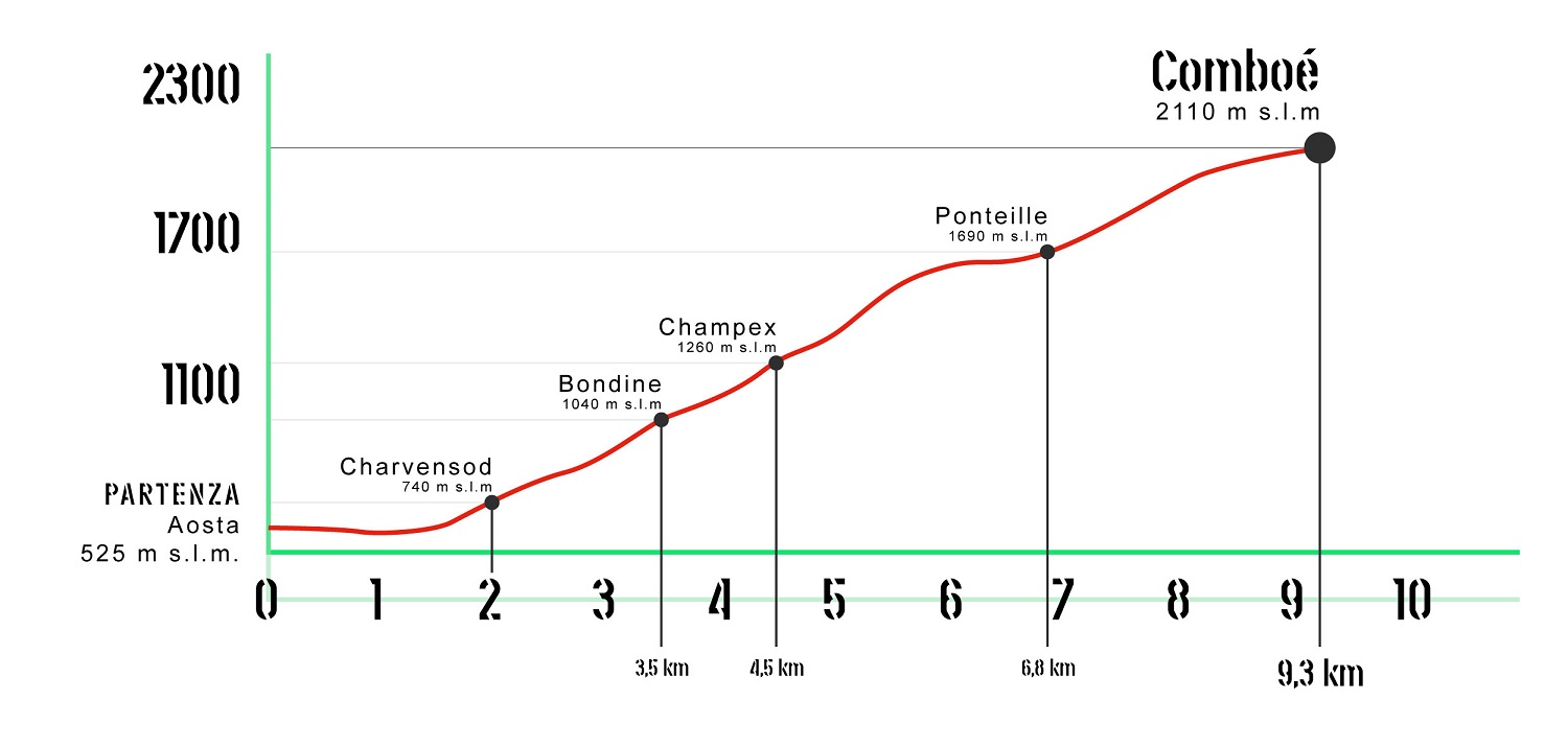
The route winds between the municipalities of Aosta and Charvensod. The departure is located in Chanoux Square in the centre of Aosta. The first 1000m are flat but after the roundabout of the Pont Suaz begins the ascent that in a few hundred meters takes the athletes to the capital of Charvensod (750m). After passing the village you leave the asphalt permanently to take the steep paths that cross the forest connect the pastures. After about 1500 meters of altitude you reach the beautiful valley of Comboé where the finish line is located.


![]() Becca di nona 3142 a.s.d.
Becca di nona 3142 a.s.d.
Località Capoluogo, 1
11020 Charvensod
91067570076 / 01208960078
Crafted with ♥ by Roberto Roux © 2020 Becca di Nona 3142 All rights reserved.